Atlantic City Maps and Orientation
(Atlantic City, New Jersey - NJ, USA)
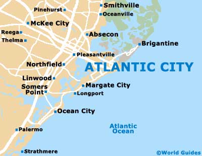
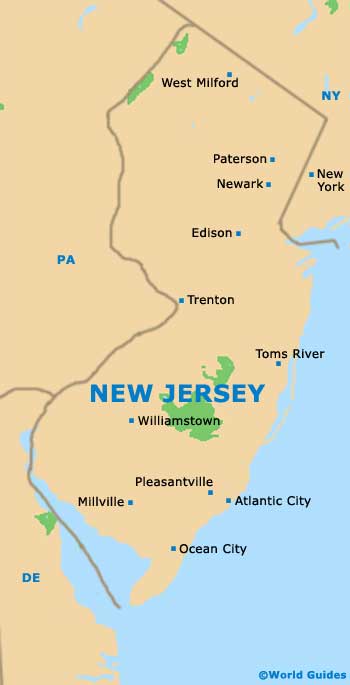
Located on the southeastern coastline of New Jersey and close to the small town of Pleasantville, Atlantic City resides on on Absecon Island and within Atlantic County, where Mays Landing serves as the county seat. The city fronts the Atlantic Ocean and has strong links to the neighboring townships of Egg Harbor and Galloway.
The city is a part of the Atlantic City-Hammonton Metropolitan Statistical Area and can be reached by a number of prominent roads, including the Atlantic City Expressway (Route-446), the Absecon Boulevard / White Horse Pike (US-30) and the Black Horse Pike (US-322).
Also of note is the Brigantine Boulevard (Route 87), which leads to the northeasterly island city of Brigantine and the Absecon State Wildlife Management Area.
Maps and Orientation of the City
If you have a hire car and are planning to drive between casinos or beaches, or to the airport, then maps may prove useful.
Maps can be obtained from bookstores along roads such as the Atlantic Avenue and the Dr. Martin Luther King Jr. Boulevard, or directly from the Visitor Center. The city's popular Visitor Center is located on Pacific Avenue, just off the Atlantic City Expressway and the South Mississippi Avenue, being a mere stroll away from the boardwalk and the Trump Plaza Hotel.
- Absecon - 8 miles / 13 km (15 minutes, northwest)
- Brigantine - 6 miles / 10 km (12 minutes, northeast)
- Egg Harbor - 13 miles / 21 km (25 minutes, west)
- Estell Manor - 22 miles / 35 km (35 minutes, west)
- Galloway - 13 miles / 21 km (25 minutes, northwest)
- Hamilton - 20 miles / 32 km (35 minutes, northwest)
- Linwood - 12 miles / 19 km (20 minutes, west)
- Longport - 7 miles / 11 km (12 minutes, southwest)
- Margate City - 5 miles / 8 km (12 minutes, southwest)
- Northfield - 10 miles / 16 km (15 minutes, west)
- Ocean City - 11 miles / 18 km (20 minutes, southwest)
- Pleasantville - 7 miles / 11 km (12 minutes, west)
- Somers Point - 14 miles / 23 km (25 minutes, southwest)
- Ventnor City - 4 miles / 6 km (ten minutes, southwest)
- Vineyard - 35 miles / 56 km (55 minutes, west)
- Wharton - 28 miles / 45 km (45 minutes, northwest)
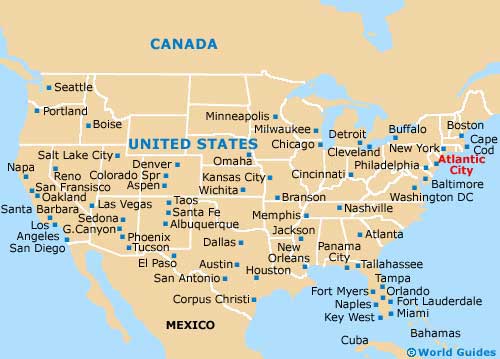
Map of the United States
Map of New Jersey
Map of Atlantic City